COVID-19 Coronavirus Notice

COVID-19 Coronavirus Notice

Updated 2 July 2020

If you are reading this message, please be aware of travel restrictions in place as part of measures to contain the spread of the COVID-19 "Coronavirus" and its symptoms. Japanese authorities are refusing entry to individuals from, or who have been to, a list of over 100 countries (More information). All other visitors must apply for a visa, and undergo a quarantine upon entering the country. Within the Japan, there are no longer any travel restrictions, and most public attractions have re-opened with precautions for sanitation and social distancing. In short, travel to Japan is not recommended at this time, until the situation normalises. I will not be editing my individual articles to reflect this, but again, please keep this in mind when reading them.

Wednesday, May 29, 2019

Kenroku-en

This article is based on a visit made on Thursday, 17 May 2018.

Edit 15 October 2019: Updated prices to reflect the increase in Japan's national sales tax.

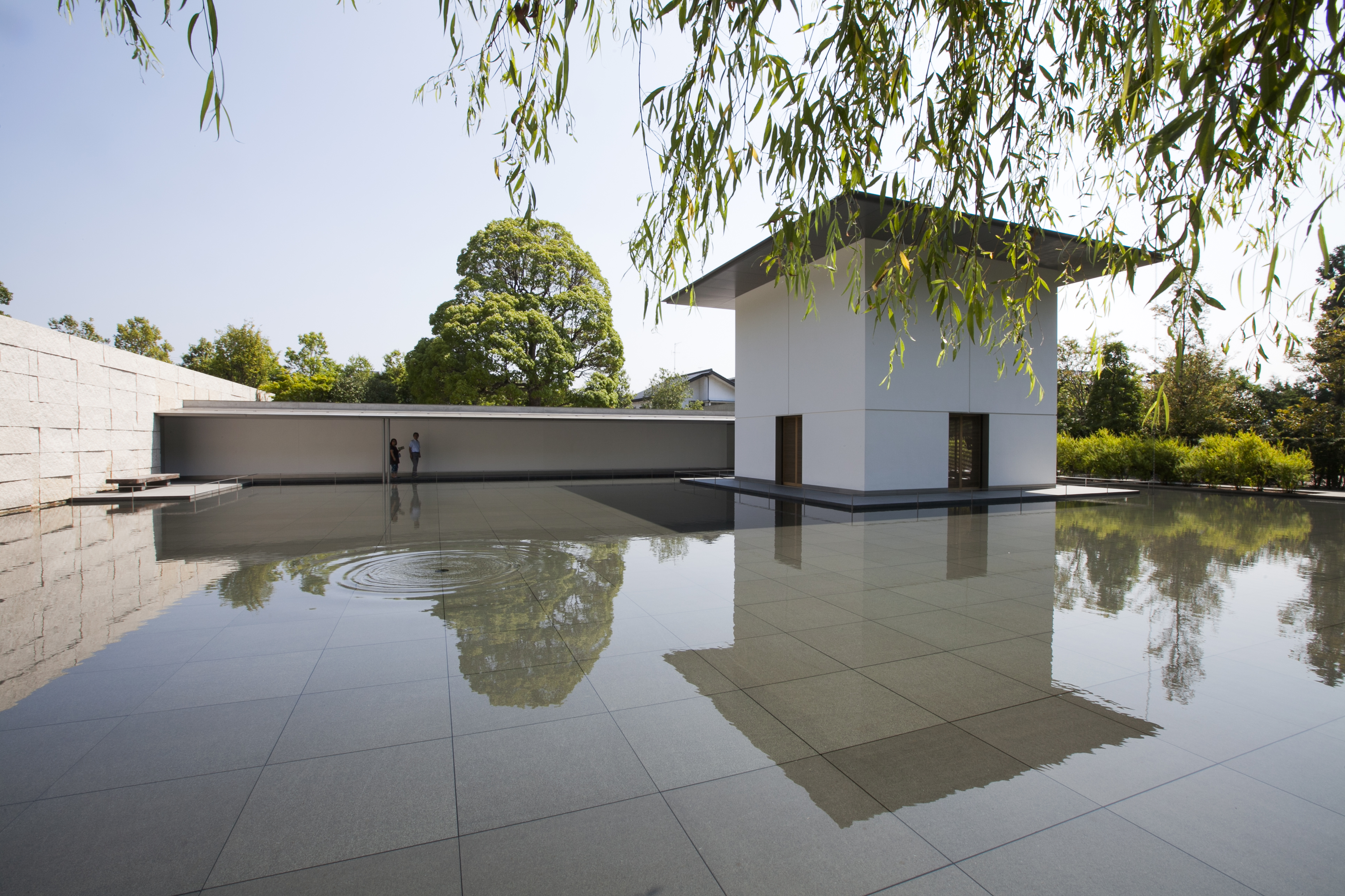
Previously on Sekai Ichi, I introduced the city of Kanazawa.  We went there on a day-trip from Toyama, where we were staying.  The day's adventures began with a visit to Kenroku-en (兼六園), a landscape garden park in the middle of the city.  Originally part of the private grounds of Kanazawa Castle, Kenroku-en has been open to the public since 1874.  Its name, meaning "garden of six attributes", refers to the six characteristics of a perfect landscape garden: spaciousness, seclusion, artifice, antiquity, water courses, and panoramas.

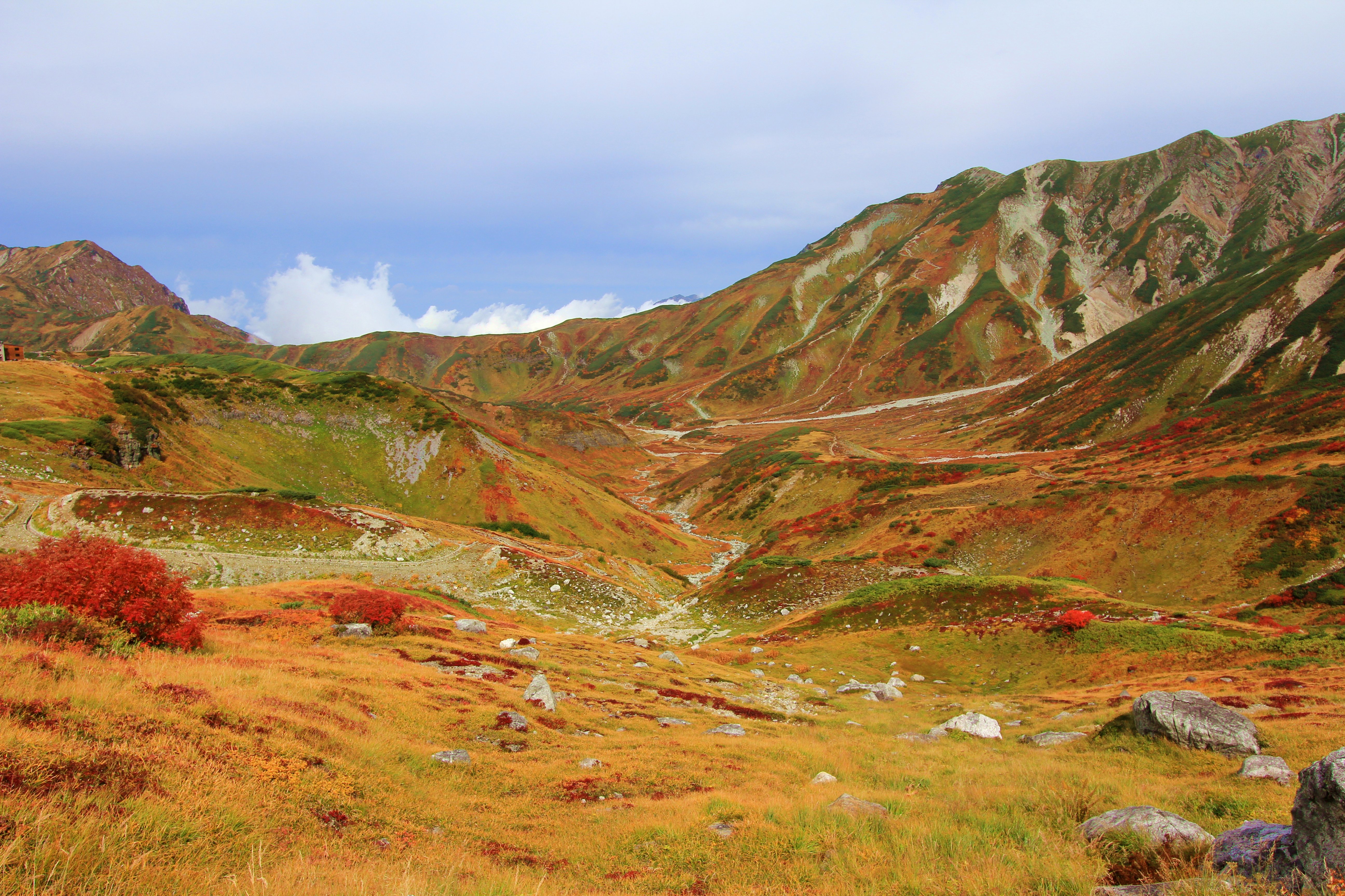
I had planned this excursion for the day before, but switched its spot with the Tateyama Kurobe Alpine Route, and that proved to be a good idea.  Whereas the previous day blessed us with plenty of sunshine, ideal for such an outdoor excursion, it rained off and on throughout our time in Kanazawa.  Then again, this should have been expected.  Kanazawa is known as one of the rainiest cities in Japan, with an average of 193 rainy days per year [1].  To get to where we would be going, we had to get through Kanazawa Station.  In 2005, its front plaza was remodelled, adding a glass dome, called the "Motenashi Dome" (もてなしドーム, lit. 'welcoming dome'), to protect travellers from the frequent rain and snow.  It is fronted by the massive Tsuzumi-mon (鼓門, lit. "drum gate"), a modernist take on the torii gate.

A bus took us from the station to Kenroku-en, our first stop for the day.    From the bus stop, the short uphill approach is lined with a few shops.  Maybe they weren't 100% historically authentic buildings or businesses, but they were atmospheric nonetheless.  Those umbrellas looked nice, but we brought our own.

Climbing up the hill, we reached the entrance to Kenroku-en.  Directly across from the park's entrance, meanwhile, is the site of Kanazawa Castle.  During the feudal age, it was occupied by the shoguns of the Maeda clan.  Many of its structures burned down in various fires over the centuries, and were never yet rebuilt.  The grounds were even used by the campus of Kanazawa University until the 1990s.  Since then, there have been efforts to reconstruct its buildings, such as the Ishikawa Gate seen above.  Today, the castle area is free to enter, with only a couple of reconstructed buildings requiring paid admission.

Near the entrance to Kenroku-en is this fountain.  Dating to the late 19th century, it is the oldest fountain in Japan.  It is powered solely by water pressure, with its source, the Sai River, flowing from uphill.  I learned this fact from a tour guide we managed to tag along with. ;-)

A short walk uphill leads to Kasumi-ga-ike (霞ヶ池, lit. "misty pond"), the largest pond in the park.  It is fed by the same water source as the fountain shown above.  You may view this panorama in full size here.

Here's another wide shot, from the other end of Kasumi-ga-ike.  The little house standing just over the water's edge, over to the left, is the Uchihashi-tei (内橋亭, lit. "inside-bridge pavilion") teahouse.  Again, full size here.

One of the most famous icons of this park is the Kotoji (徽軫灯籠, Kotoji-tōrō) stone lantern.  It is named after the koto, the string instrument I saw performed earlier at the Gion Corner in Kyoto, since the shape of its two curved legs resemble the bridges that hold up a koto's strings.

Of course, Kotoji-toro isn't the only stone lantern in town.  This one stands behind the "Flying Geese Bridge" (雁行橋, gankō-bashi), so named because the V-shaped arrangement of its stepping-stones resembles the formation of geese in flight.

Here's a close-up of some bright pink, raindrop-decked azaleas from near the kotoji-toro...

...and similarly-rainy irises.  There are rows of these irises planted along some riverbanks, which you can spot from the aptly-named "flower-viewing bridge" (花見橋, hanami-bashi).

Moving on to non-floral plants, Kenroku-en has a number of sprawling pine trees.  This one, which is so large and twisted it requires all these supports under its branches, is the Karasaki Pine (唐崎松).  It is named after Karasaki, a town on the southwestern shore of Lake Biwa, from which lord Maeda Narinaga (前田 斉広, 1782-1824) received the seed he used to plant it.

No machine-readable author provided. Jovandavid~commonswiki assumed (based on copyright claims). [Public domain], via Wikimedia Commons
In preparation for the winter, this and other trees are protected from the snow by yukitsuri (雪吊, lit. "snow-hanging"): tall poles draped by a series of ropes, forming cone shapes on top of the trees.  The ropes are tied on the other end to branches of the trees, in order to support them against the weight of snow.  Yukitsuri can also be seen in parks in Tokyo, despite the fact that Tokyo gets far less snow per year than, say, Kanazawa; they mostly serve as a sort of seasonal indicator.

Out near the eastern corner of the park stand the Meiji Monument, topped by a statue of Prince Yamato Takeru (日本武尊/倭建命, Yamato Takeru no Mikoto, c. AD 78-112).  According to ancient Japanese texts such as the Kojiki and Nihon Shoki, Prince Yamato was a son of the Emperor Keiko.  His adventures included assassinating a rival clan leader by cross-dressing as one of his maidservants.  This monument is dedicated to casualties of the Satsuma Rebellion, a.k.a. the Seinan War, which took place on Kyushu in 1877.

Near the western corner of the park stands the Shigure-tei (時雨亭, lit. 'Autumn rain pavillion') teahouse.  This villa was established in 1725, under lord Maeda Yoshinori (前田吉徳, 1690-1745).  After being torn down in the early Meiji period, it was reconstructed in 2000 based on recovered floorplans.  At the Shigure-tei, you may order green tea sets as you gaze out upon smaller-scale, but no less cultivated, garden landscapes.

I ordered a couple of tea sets at Shigure-tei.  It wasn't quite as splendid as what I had at the Hakone Museum of Art, but then again, this time around I cheaped out and got the basic set (¥310), which includes regular leaf-based green tea, a slightly-sweet wafer, and a couple of slightly-sweeter sugar pieces.  For ¥720, you will get tea made from finer matcha powder, and an original, likely hand-made, namagashi (生菓子) sweet.  Whichever set you decide upon, the soft, quiet ambiance of the place makes this a worthwhile diversion.

I took our sign-off selfie in front of the kotoji-toro, because how could we not.  But after we were finished with Kenroku-en, our next stop would be something a little less obvious... unless you know me.  Find out where, next time on Sekai Ichi!


Kenroku-en

Hours: Open from 7:00 AM to 6:00 PM, or from 8:00 AM to 5:00 PM between mid-October and February.  Early admission starts at 4:00 AM from April to August, 6:00 AM from November to February, and 5:00 AM the rest of the year.  The Shigure-tei teahouse is open from 9:00 AM to 4:30 PM; last orders are 30 minutes before closing time.

Cost: ¥320.  Entry is free during early admission periods, but visitors must leave the park 15 minutes before regular opening time.

Address: 1 Kenrokuen-machi, Kanazawa-shi, Ishikawa-ken 〒920-0936

Access: Multiple buses run between Kanazawa Station and Kenroku-en.  All buses depart from the station's East entrance.
  • From bus platform 4, take a JR West bus to Kenrokuen-shita (12 minutes, ¥200, JR Pass OK).  Only 1-3 buses per hour pass by this stop.  Schedule: (Japanese)
  • From platform 6, take the Kenrokuen Shuttle bus to Kenrokuen Garden & Kanazawa Castle Park (20 minutes, ¥200).  This bus costs only 100 on weekends and holidays.
  • From platform 7, take the Kanazawa Left Loop or Right Loop bus to Kenrokuen Garden & Kanazawa Castle Park (25 minutes, ¥200).
Website: (English) (Japanese)

Kanazawa Castle Park

Hours: Same as Kenroku-en above.  The storehouse and turrets are open from 9:00 AM to 4:30 PM; last entry is 30 minutes before closing time.

Cost: The castle grounds are free to enter.  Admission to the storehouse and turrets costs ¥320.

Address: 1 Marunouchi, Kanazawa-shi, Ishikawa-ken 〒920-0937

Access: See the directions to Kenroku-en above.  From Kenroku-en's Katsurazaka entrance, go across the overpass to reach the castle park.

Website: (English) (Japanese)


[1] Number of days with total rainfall measured at 0.5mm.  Source: Japan Meteorological Agency.  Retrieved 9 May 2019. http://www.data.jma.go.jp/obd/stats/etrn/view/nml_sfc_ym.php?prec_no=56&block_no=47605&year=&month=1&day=&view=a1

Wednesday, May 15, 2019

Introduction to: Kanazawa

Edit 11 October 2019: Updated prices to reflect the increase in Japan's national sales tax.

Kanazawa (金沢, lit. 'gold marsh') is the capital city of Ishikawa Prefecture.  During the Edo Period, Kanazawa was the seat of the Maeda clan, whose riches were second only to the Tokugawa Shogunate itself.  From all this wealth, the city hosted production of many fine crafts, such as gold leaf and ceramic pottery.  Since much of Kanazawa's value was historical and cultural, rather than industrial, it was never targeted for air raids in World War II, the second-largest city (behind Kyoto) to bear this fortunate distinction.  This has led to the preservation of several teahouse and samurai districts, along with Kenroku-en, one of Japan's top three landscape gardens.  And yet, Kanazawa had managed to stay off the tourism radar, but that changed in 2015, when the Hokuriku Shinkansen was extended to the city.

Main attractions

1) Higashi Chaya District: The largest of Kanazawa's teahouse districts, in the northeast of the city.

2) Kanazawa Castle Park: The site of the partially-rebuilt Kanazawa Castle.

3) Kenroku-en: One of the three most famous landscape gardens in Japan.

4) 21st Century Museum of Contemporary Art: A modern art museum with unique sculptures and installations.

By 金沢市 (http://open-imagedata.city.kanazawa.ishikawa.jp/) [CC BY 2.1 jp], via Wikimedia Commons
5) D.T. Suzuki Museum: A sleek, contemplative museum about Daisetz Teitaro Suzuki, a Buddhist philosopher.

By そらみみ [CC BY-SA 4.0], from Wikimedia Commons
6) Oyama-jinja: A downtown Shinto shrine fronted by a Dutch-style gate.

7) Nagamachi: A former samurai district with preserved buildings and a few museums.

By 金沢市 (http://open-imagedata.city.kanazawa.ishikawa.jp/) [CC BY 2.1 jp], via Wikimedia Commons
8) Nishi Chaya District: The secondary teahouse district in the southwest of the city.

By Oren Rozen [CC BY-SA 4.0], from Wikimedia Commons
9) Myoryu-ji: A Buddhist temple, also known as the "ninja temple" for its secret defences.

Orientation

Kanazawa is centred around the Kanazawa Castle Park and Koraku-en garden, with Kanazawa Station off to the northwest.  The station and most other sites are within two kilometres of the parks, so the city is accessible on foot for good walkers.  For everyone else, there are a few buses that run through the city.
  • The Kanazawa Left Loop and Right Loop buses start and end at the station, and hit many popular sights in an anticlockwise or clockwise loop, respectively.  Loop buses arrive at any given stop every 15 minutes and cost a flat rate of ¥200 per ride. More information: (English)
  • The Kenrokuen Shuttle Bus follows an abridged version of the loop bus itinerary.  From Kanazawa Station, it heads to the Kenroku-en area and back.  Shuttle buses arrive every 20 minutes, and cost ¥200 per ride on weekdays, or ¥100 on weekends.
    • A one-day free pass for both the Kanazawa Loop and Kenrokuen Shuttle buses costs ¥500.  Purchase it from the Transportation Information Centre, just outside the East exit of Kanazawa Station, or the Hokutetsu Bus Terminal, out and to the left of said exit.
  • JR West also operates their own local bus route from Kanazawa Station to Kenroku-en, the Higashi Chaya district, and beyond.  These buses arrive 1 to 3 times per hour.  Fares start at ¥200, and are free with the Japan Rail Pass.  However, the above-mentioned loop/shuttle bus pass is not valid on these JR buses.  Schedules: (Japanese)
Apart from buses, the following rail companies operate around Kanazawa:
  • JR West operates the high-speed Hokuriku Shinkansen, to the northeast, and the local Hokuriku Main Line, to the southwest.
  • IR Ishikawa Railway operates the IR Ishikawa line to the northeast.  This line used to be part of the Hokuriku Main Line, but was spun off into its own company when the Hokuriku Shinkansen opened.
    • The Japan Rail Pass may not be used on the IR Ishikawa Railway.  However, it is valid on the section between Kanazawa and Tsubata Stations, as long as you only get on/off at those stations.
  • Hokutetsu, or Hokuriku Railroad, operates two short suburban lines.  The Asanogawa line goes north from Kanazawa Station, and the Ishikawa line goes south from Nomachi Station, near the Nishi Chaya district.
Access

On 14 March 2015, the Hokuriku Shinkansen was extended to Kanazawa Station, providing a direct rail link to Tokyo for the first time.  Kanazawa is served by Hakutaka, Kayagaki, and Tsurugi services, the latter of which terminate at Toyama.  Coming from the other direction, western cities are also served by limited express trains such as the Shirasagi from Nagoya, and the Thunderbird from Kyoto and Osaka.  If you are coming in from Nagoya, it may be faster to take the Tokaido Shinkansen to Maibara (30 minutes, Kodama/Hikari only), and then take the Shirasagi from there (2 hours, total ¥8,160 reserved).  All of the above train options are covered by the Japan Rail Pass.

City Time
(Hakutaka)
Time
(Kayagaki)
Time
(Tsurugi)
Time
(Shirasagi)
Time
(Thunderbird)
Fare
(Reserved)
Tokyo 180 minutes 150 minutes N/A N/A N/A ¥14,380
Nagano 90 minutes 65 minutes N/A N/A N/A ¥9,120
Toyama 25 minutes 20 minutes 25 minutes N/A N/A ¥3,390
Nagoya N/A N/A N/A 180 minutes N/A ¥7,460
Kyoto N/A N/A N/A N/A 120-140 minutes ¥7,020
Osaka N/A N/A N/A N/A 150-170 minutes ¥7,790
Times and fares are based on May 2019 schedules and are subject to change.

The closest airport to Kanazawa is Komatsu Airport (IATA code: KMQ), located about 30 kilometres (18 miles) southwest of central Kanazawa.  It serves a few domestic (Tokyo, Sapporo, Fukuoka, etc.) and international (Seoul, Shanghai, Taipei, and Hong Kong) locations.  More information: (English) (Japanese)

To get to Kanazawa from the airport, take a bus to Komatsu Station (12 minutes, 2 per hour, ¥280) and ride the JR Hokuriku line to Kanazawa (35 minutes, ¥510).  Most Thunderbird and Shirasagi trains also stop at Komatsu Station (17 minutes, ¥1,800 reserved).  Or, there are direct buses that go between the airport and Kanazawa Station (40 minutes, 1-2 per hour, ¥1,150).  More information: (English)

Excursions

1) Takaoka: A neighbouring city with a rich bronze-casting history and one of Japan's largest Buddha statues.
Access: Hokuriku Shinkansen (Hakutaka/Tsurugi) from Kanazawa Station to Shin-Takaoka (15 minutes, ¥1,560 non-reserved, JR Pass OK); or IR Ishikawa / Ainokaze Toyama Railway to Takaoka (40 minutes, ¥840).

2) Toyama: A port city, ideal as a base for exploring the northern Chubu region.
Access: Hokuriku Shinkansen from Kanazawa Station to Toyama (20 minutes, ¥3,390 reserved, JR Pass OK).

3) Kaga Onsen: A nearby collection of hot-spring towns and museums.
Access: JR Thunderbird/Shirasagi limited express from Kanazawa to Kaga Onsen Station (25 minutes, 1-3 per hour, ¥2,060 reserved, JR Pass OK).

4) Shirakawa-go: A secluded village famous for its thatched-roof farmhouses, where one can stay overnight.
Access: Bus from Kanazawa Station (East exit) to Shirakawa-go (85 minutes, 1-2 per hour, ¥2,000 one-way / ¥3,600 round-trip) (Schedule).

5) Haku-san: A 2,702-metre (8,864 ft.) peak, regarded as one of Japan's most sacred mountains.
Access: Bus from Kanazawa Station (East exit) to Bettodeai (2 hours 15 minutes, 1-3 per day, ¥2,240) (Schedule).

6) Wakura Onsen: A hot-spring resort city, ideal as a base for exploring the remote Noto Peninsula.
Access: JR Noto Kagaribi limited express from Kanazawa to Wakura Onsen Station (60 minutes, ¥2,800 reserved, 1 per 2-3 hours, JR Pass OK).

Tuesday, May 14, 2019

Alpine Route Part 3: Murodo to Kurobe Dam

This article is based on a visit made on Wednesday, 16 May 2018.

Edit 11 October 2019: Updated prices to reflect the increase in Japan's national sales tax.

Previously on Sekai Ichi, my grandmother and I reached the peak of the Tateyama Kurobe Alpine Route, the Murodo Highlands.  But this was only the half-way point of our adventure.

To pick up from where we left off, we took the Tateyama Trolleybus from a station directly adjacent to the Tateyama Hotel.  A trolleybus is a bus that is powered by overhead electrical lines, like a trolley or a bumper car.  This particular trolleybus drives through a tunnel narrow enough for only one bus at a time.  However, like the earlier cable cars, there is a section in the middle which allows buses heading in opposite directions to pass each other.

At the other end, we find ourselves at Daikanbo, the upper station of the Tateyama Ropeway.  With a distance of 1.7km (1.1 mi.), and a vertical difference of 488m (1,601 ft.), this is the world's longest aerial lift without any mid-span supporting towers.  Due to the limited capacity of the cars, this is one of the Alpine Route's more infamous bottlenecks.

If you do find yourself with extra time to spare, you can walk upstairs to the observation deck, which looks out upon the Kurobe Dam and the surrounding valley.  Or, just do what I did, and take pictures from the front of the gondola.

Upon alighting at the lower station, Kurobedaira, we then have one more ride to go before reaching the Kurobe Dam, and it is the Kurobe Cable Car.  We already went through one of these at the other end, so you know the deal by now.

Finally, we reach the Kurobe Dam.  It was constructed between 1956 and 1963 to meet the growing electricity needs of western Japan in the post-World War II period.  At 186 metres (610 feet) tall and 492m (1,614 ft.) wide, it is the largest hydroelectric dam in Japan.

As part of the Alpine Route, visitors will have to cross the dam on foot.  This simple walk should only take ten to fifteen minutes.  Along the way, you will get to see views such as this one, looking downstream to the north.

The other side, to the south, consists of the dam's reservoir, Lake Kurobe.  I didn't find the views from this angle quite as appealing, due to all the tree trunks and other detritus that had washed up to the edge of the dam.  But, I suppose that algae-fueled emerald-green colour is brilliant in its own way.

Wherever you take pictures from, be very careful to keep a tight grip on your camera, or whatever you're taking pictures with!  I would hate for you to drop it from so far up!

On the east side of the dam stands a restaurant and gift shop, as well as a small museum about the construction of the dam, which is free to visit but only has descriptions in Japanese.   At the end of the hall is a mockup of the tunnel that was dug out to reach the area from across the neighbouring mountains.  Reportedly, a total of ten million people were involved in the project which, if true, would be over 10% of the population of the entire country at the time (e.g. over 94 million people in 1960).  171 of those people died while working on the dam.  They are honoured by a memorial statue, located on the east side of the dam, a bit along the lake.

If you want a better view of the dam, there are two additional places you can choose to head to.  The first is an observation deck situated at the top of a 220-stair, 15-minute ascent.  It's a bit of a hike for some people.

If that sounds too hard, or time-consuming, you can also go down a shorter staircase to a newer observation deck, which brings you much closer to the dam.  This looks like a spectacular place to see the water discharges which take place from June through October.  As of this article, the discharges will next take place from 26 June through 15 October 2019.  Those deluges, and the rainbows that often form amidst the sprays, would certainly make the sight of this dam less drab, but when you're here in person, the sheer scale of this thing is always impressive in its own right.

Another activity I was unable to take advantage of at the time is the "Garve" pleasure cruise, which makes 30-minute trips around the lake from June to early November.  Tickets for this ride cost ¥1,080.

The mascot of Kurobe Dam is a black cat in a hard hat, called Kuronyon.  "Kuro" means "black", and "nyon" is a Japanese word for the sound a cat makes.  Naturally, he is featured on plenty of merchandise sold here...


...as is "Dam Curry", a specialty of the local restaurant.  Here, the rice forms an arched dam shape to hold back the sauce, which is blended with spinach to create a green tint.  If the thought of this tickles your taste buds, the gift shop sells packs of this curry mix for you to make at home.  If not... well, you can always buy this dish in plastic keychain form.

Once we're done here, one last official leg of the Alpine Route remains, and that is the Kanden Trolleybus.  "Kanden" here is short for Kansai Electric Power Company (KEPCO), the company which owns and operates the Kurobe Dam.  The tunnel used by the trolleybus today, which crosses the boundary between Toyama and Nagano Prefectures, was originally dug out to transport people and materials for building the Kurobe Dam.  As with the other trolleybus, the tunnel is wide enough only for single buses, apart from a passing section in the middle.

And with that, we are pretty much finished!  All that's left to do, besides this sign-off selfie I took at the bus station, was to find our way back to our hotel.  For some, this may involve taking a local bus to one of the hot-spring resorts in the town of Omachi.  For us, that involved taking an express bus to Nagano, and the Hokuriku Shinkansen back to Toyama.  Finally, after such a hectic but interesting day, we had earned our rest.  We would follow that up, with a considerably more relaxed start, by taking an excursion to an all-new city, which I invite you to join me on, next time on Sekai Ichi!


Kurobe Dam

Hours: The dam itself is open 24 hours, but transportation to/from the dam is not.  For most seasons, the first Kanden trolleybus leaves Ogizawa for Kurobe Dam station at 7:30 AM, and the last returning bus departs for Ogizawa at 5:35 PM.  Closed, along with the rest of the Alpine Route, from mid-November to mid-April.  The "Garve" pleasure cruise operates from early June to mid-November, and runs daily from 9:00 AM to 3:00 PM.  Schedule: (English)

Cost: Free.  The "Garve" pleasure cruise costs ¥1,080 per ride.

Address: Ashikura-ji, Nakaniikawa-ku, Toyama-ken 〒930-1406

Access: Kurobe Dam is part of the Tateyama-Kurobe Alpine Route.  From Shinano-Omachi station, take a bus to Ogizawa Station (40 minutes), followed by the Kanden Trolleybus to Kurobe Dam (16 minutes).  Round-trip fare for this section costs ¥5,110.

Website: (Japanese)

Monday, May 13, 2019

Alpine Route Part 2: Murodo

This article is based on a visit made on Wednesday, 16 May 2018.

Previously on Sekai Ichi, my grandmother and I embarked on a day-trip across the Tateyama Kurobe Alpine Route.  In the first half, we climbed uphill via the Toyama Chiho Railway, the Tateyama Cable Car, and a bus.  All of that led us to Murodo (室堂), a plateau sitting at 2,450 metres (8,038 feet) above sea level, and the highest point of the Alpine Route.

The buses drop you off at the Hotel Tateyama, the highest hotel in Japan by elevation.  For those not staying overnight, it also has a restaurant, gift shop, and is directly connected to the next section of the Alpine Route, the Tateyama Trolleybus.  But let's not get ahead of ourselves.

The Alpine Route's website claims that Tateyama receives some of the world's heaviest snowfalls.  Citation needed on that statement, but I can certainly attest that there was lots and lots of snow to go around.  In fact, the snowfall accumulated here during any given winter doesn't fully melt until the middle of summer, if at all!  To view this panorama in full size, click here.

In order to clear the roads for the Alpine Route, all that snow has to be dug out, forming a massive "snow corridor" (雪の大谷, yuki no ōtani).  A 500m (1,640 ft.) section of this canyon, starting from the parking lot of Hotel Tateyama, is partially roped off for pedestrians to walk down and get a closer look.  This snow canyon can measure up to 20 metres (66 feet) tall.

On this occasion, the snow wall was measured to be 14 metres (46 feet) tall.  Given that this was a month into the open season, that's not too shabby!  They also logged the temperature at 7° Celsius (45° Fahrenheit), which was considerably cooler than the lower portions of the Alpine Route, so when traversing the route, I would definitely suggest wearing layers.

So many people had drawn messages and little pictures in the snow...

...that I felt like doing one myself.

Along the way, we got our picture taken with stuffed models of rock ptarmigans (雷鳥, raichō, lit. 'thunder bird').  The ptarmigan breeds in arctic and sub-arctic regions, including Alaska, Canada, Greenland, Iceland, Scotland, Norway, Russia, and the mountains of Central Japan, where we are now.  It has even been designated the official bird of Toyama, Gifu, and Nagano prefectures, all of which border the Japan Alps.  If you recall my last few articles, this so-called "thunder bird" inspired the name of the train we took to get from Kyoto to Toyama.  More information on ptarmigans and other wildlife of the area can be learned at the Tateyama Nature Conservation Centre, a free museum next-door to the hotel.

Back in the lodge, we dug into a lunch of pork cutlets, then bought some postcards and mailed them right from the shop.  I also bought these papercraft models of buses and cable cars from the Alpine Route, which I had to fold and stick together myself.  There were plenty of tricky bits, but I think I got the hang of it by the end!


The Murodo Highlands in autumn, taken 6 October 2012.
くろふね [CC BY 3.0], via Wikimedia Commons
As marvellous as the snow canyon is, it overshadows, and in some cases precludes access to, many other natural wonders around the area.  This includes the very same landscape in different seasons.  The scenery that is blanketed by white snow in winter and spring turns green in the summer, and gold with red bushes in the autumn.

Mikurigaike, taken on 1 August 2015.
くろふね [CC BY 3.0], via Wikimedia Commons
There are numerous volcanically-formed ponds around the area, the biggest being Mikurigaike (ミクリガ池).  The reflections from this clear blue lake are truly brilliant.  Walking here from the Tateyama Hotel takes only 15 minutes one-way.

Mikurigaike Onsen, taken on 15 July 2018.
Saigen Jiro [CC0], via Wikimedia Commons
Just beyond the pond is Mikurigaike Onsen, Japan's highest public hot-spring facility by altitude.  The indoor baths here offer sweeping views of the Murodo Plateau.  This place also has dormitories and rooms to stay the night in.  Hotel Tateyama also has hot-spring baths, but they are for staying guests only.

Murodo's jigokudani, taken on 13 November 2015.
Alpsdake [CC BY-SA 4.0], via Wikimedia Commons
The Murodo plateau also has its own "hell valley" (地獄谷, jigokudani), where volcanic gases are vented from the barren ground.  The source of these is a small volcano, somewhere along the edge of the plateau, whose last eruption was a small one in 1839.  Walking trails pass through here too, but they are frequently closed off due to volcanic activity.

Oyama, and the shrine that stands atop it.
Alpsdake [CC BY-SA 4.0], via Wikimedia Commons
From Murodo Station, it is even possible to hike up to the top of Mount Tate (立山, lit. 'standing mountain').  Tate-yama consists of three adjacent peaks, of which the 3,003m (9,852 ft) Oyama (雄山, lit. 'masculine mountain') is the most popular for climbers.  From the Tateyama Hotel, the trail to Oyama is 2.5km (1.5 mi) long and takes about 2 hours to ascend.  It is more strenuous than other paths in the area, but does not require special equipment beyond sturdy hiking shoes and warm clothing.

As for me... let's not and say we did.  I can, at least, prove I was in the general area with this sign-off selfie of me mailing our postcards.  With Murodo, we have perhaps reached the peak of the Tateyama Kurobe Alpine Route, in more ways than one.  But there remains the entire second half of the route to be seen, including the nation's tallest dam.  Check it out with me, next time on Sekai Ichi!


Hotel Tateyama

Cost: As of May 2019, the average rate per person/night is ¥22,000 to ¥28,000 for a twin room.  Rates include dinner and breakfast.

Address: Ashikura-ji, Tateyama-chō, Nakaniikawa-gun, Toyama-ken 〒930-1414

Access: The hotel is adjacent to Murodo Station.

Website(English) (Japanese)

Tateyama Nature Conservation Centre

Hours: Open from 8:30 AM to 5:00 PM.  Opens at 8:00 AM from 16 July to 31 August.

Cost: Free.

Address: Ashikura-ji, Tateyama-chō, Nakaniikawa-gun, Toyama-ken 〒930-1414

Access: The museum is 1 minute on foot from the 2nd-floor entrance of Hotel Tateyama.

Website: (English) (Japanese)

Mikurigaike Onsen

Hours: Baths open for day use from 9:00 AM to 4:00 PM.

Cost: ¥700.  Bath and face towels cost ¥300 each to rent.

Address: Murododaira, Tateyama-chō, Nakaniikawa-gun, Toyama-ken 〒930-1414

Access: The spa is 15 minutes on foot from the 3rd-floor rear entrance of Hotel Tateyama.

Website(English) (Japanese)